Canyon Rover:
GCHBA Volunteer Service Project - Vandalism and Poop Patrol on the Corridor Trails of Grand Canyon NP /
Grand Canyon Hikers and Backpackers Ass. (GCHBA) / Painting Ramadas at IG, Refurbishing the River Ranger Station
(March 27 to April 5th, 2017)
Text
© copyright by Rob; and Photos © copyright by Rob Jones
|
 |
Co-Adventurer VIPs: Annette A., Cuyler B., Tom B., Barry B., Holly B., Kathy H., Mike H., Rob J., Barry J.,
Tim K., & Marcos S.
Mule packing by packers of the NPS
(National Park Service).
Site-based planning by Elyssa S. and Jeff S. (with thanks to Debbie B., Jacob T.,
Canyon Ranger District; Todd N., NPS and Jamie R. NPS intern)
GCHBA planning and organization by Rob Jones, GPP-SP
(Grand Penultimate Poobah of GCHBA Service Projects).
VIP is Volunteer In Park.
This volunteer service project was supported by the NPS people who put the "Service!"
in NPS; and by the members and Board of the GCHBA (Grand Canyon Hikers and Backpackers Association). Thanks for
your stewardship of our precious public lands.
camera: Panasonic DMC-ZS19
Note: the opinions in this report are not necessarily those of the GCHBA or its Board. However, the
spirits found in the remaining picto and petroglyphs approve this report.

|
|---|
Western Bluebird on the Rim, Day 1
(Click the image for the full-size image)
|
|---|
|

|
|---|
Painting an IG Ramada, Day 3
(Click the image for the full-size image)
|
|---|
|

|
|---|
Removing vandal marks on the South Kaibab, Day 2
(Click the image for the full-size image)
|
|---|
|

|
|---|
Redbud bloomer on the BA Trail, Day 3
(Click the image for the full-size image)
|
|---|
|

|
|---|
Snow on Buddha Temple, Day 8
(Click the image for the full-size image)
|
|---|
|

|
|---|
Digging holes for permit posts (BA), Day 3
(Click the image for the full-size image)
|
|---|
|
|
|---|
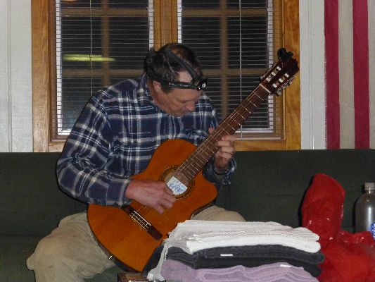
Movie: Barry J. plays classical guitar in the IG Bunkhouse, 7.5mb, Day 2
(Click the image to see the short video)
|
|---|
|
ERM = Energy Required Miles. A mile is added for
every 500' elevation gain or
loss. It's a very serviceable method of estimating energy required miles. ERM was initially used in Trails
of the Tetons (long out of print) by Paul Petzold, founder of NOLS. It's a wonderfully useful concept and
application. Add one mile for each 500' up AND down to distance = ERM. I use ERMs to calculate what the actual
day is like. It's a very serviceable method of estimating energy required miles. Remember, however, that the
ERMs are estimates because they depend on GPS satellite coverage and math functions.
Using ERMs does not account for the 'texture' of the route or trail - that
is, rocky, boulders, no trail, slimy mud, etc., yet does help approximate the route.
See more information about ERMs at the end of this report.
Overview: This is a report about yet another GCHBA
(Grand Canyon Hikers and Backpackers Association) volunteer service project in The Canyon. This time,
our group of 11 VIPs (Volunteer In Park) was split between IG (Indian Garden); where we painted all the
shade structures (ramadas); and at BA (Bright Angel); where we predominantly worked in the campground and
the River Ranger Station). We also roved the corridor trails removing graffiti vandalism marks and
collecting trash (including, ick, poop). Poop patrol - this is quite a subtitle. See the list of tasks
for a hint of what we accomplished.
We owe this YUGE list of accomplishments, in part, to the extra work and
efforts of the Canyon District Rangers (Ellysa S., Jeff S., Debbie B., Jacob T.) and help with logistics
from the NPS Packers and Todd N. and Jamie R. from the volunteer office. Without the pre-project work of
these Rangers (most especially Ranger Elyssa!), the list would have been much shorter. Thanks guys.
Again, this VIP crew was superbly talented and hard working. We of the
GCHBA are serious about helping the NPS provide stewardship to our public lands. We accept the challenge
to give back to the lands we love.
I hope you enjoy the photos and such, and that you are all over your
congresspeople to properly fund and support and care for our public lands, Rob, GPP-SP (Grand Penultimate
Poobah - Service Projects).
Day 1, March 27th. Pack and Fly. 4 miles.
Sherds of snow?
Elk romp through the brush as we eat dinner in Maswik Lodge.
It is an early morning drive to the South Rim and the BIC to organize the food boxes. This done, Tom and I
set up tents in Mather and then enjoy lunch at Yavapai Cafeteria before a cross-country walk to the rim.
Shards of snow skitter past on the Southern gale. A sherd is a pottery chunk, while a shard is like glass.
It's a cold afternoon on the South Rim.
|
Tasks Accomplished List 3-2017 GCHBA (pdf)
(Click the image for the document)
|
|---|
Canyon Rover - Day 1
Day 2: To Indian Garden via South Kaibab
9 miles; ERM = 16. Vandal Panels.
Again with the graffiti all over the precious rocks. Horrid. Holly, Annette,
Marcos, and I are inching down the South Kaibab scanning for insults to our public lands graciously left by
self-centered, selfish dolts. Carving initials in rocks, writing on pine limbs, scribbles demonstrating the
intellect of the vandal, "Send nudes," and other high powered writing.
We work down to the Tipoff by 3 p.m. for lunch #2, after which we hustle
across the 4.5 miles to IG for
a delectable deluxe lasagna delight prepared by Ranger Elyssa. Yummy.
Know - Kaibab Limestone
The - Toroweap Formation
Canyon's - Coconino SS
History - Hermit Shale
Study - Supai Group (including the Esplanade)
Rocks - Redwall Limestone
Made - Mauv Limestone
By - Bright Angel Shale
Time - Tapeats SS
Know The Canyon's History, Study Rocks Made By Time.
Canyon Rover - Day 2
Day 3: SK Drifting. 8 miles; ERM = 11.
Brittlebush blush the ranging views of The Canyon an encompassing
yellow. I'm on a graffiti tour of the lower South Kaibab Trail, inching along toward the bottom of
The Canyon. Again, too many cretins have left their mark.
I meet Ben Cooper of P-SAR, and then two mule riders from Xantera, Ed
and John, exploring for a route to use instead of the lower BA, where a giant rock slide has eliminated
the trail. The slide occurred around 4:30 a.m. yesterday morning. This rock slide also alters our plans.
There's a gorgeous flower fest on the Tonto, featuring Mariposa Lily,
Claret Cup Cactus, Blackbrush, Paintbrush, Globe Mallow, penstemon, and the spectacular purple haze of
the Red Bud in the Indian Garden area.
Mike, Kathy, Holly, and Annette are working in the BA Campground
and the River Ranger Station, installing permit box posts, building shelves, lots of stuff.
It's good to see this segment of our group, although only for the evening.
Canyon Rover - Day 3
Day 4: Lower Bright Angel Bounce. Graffiti patrol from BA to Indian Garden.
5 miles; ERM = 8.
Barry J plays classical guitar as the North Rim buttes disappear into the
flying rain, and snow on the North Rim, while we shelter in the IG Bunkhouse, awaiting another scrumptious
round of Ranger Elyssa lasagna. Elyssa made enough delectable lasagna that we are cleaning up left-overs
today. Thanks Elyssa.
The day starts with mild temperatures at Bright Angel. I'm struggling with
packing the food muled down to BA into my pack to return it to IG. Plans have changed, and Marcos and I are
not roving the North Kaibab Trail on poop patrol. Instead, we're concentrating on painting the shade
structures at IG campground.
The slow hike up from BA goes well, and the slide area has been cleared
for hikers, yet not yet mules.
As dinner progresses, the threat turns to a hearty pounding rain, followed
by a power outage that lasts throughout the night. We're all thankful that the lasagna has been cooked and
enjoyed. And visions of baked lasagna lilt through my dreams.
Canyon Rover - Day 4
Day 5: Grand Canyon Brown, All Around. 1 mile; ERM = 1. Painting the shade
structures at IG campground.
The wind blows down my neck and a cold drizzle flakes off the roof of
the #6 ramada. I huddle farther under the ramada roof, where I am painting the rafters. Grand Canyon brown
is all around; on my hat, shirt, pants, and some on the shade structure (ramada).
A glimpse of the North Rim reveals snow on the upper levels. Layers above
the Redwall Limestone are girded with new white precipitation.
It's another day painting in the Indian Garden Campground for most of the
crew. Burr.
Lunch in the bunkhouse is a warming and raucous affair. More painting and
it's dinner time.
Canyon Rover - Day 5
Day 6: Grand Canyon Brown Bat. More painting. 2 miles; ERM = 2.
The Grand Canyon Brown Bat hangs inverted from rear claws beneath
the ramada as Tom, Marcos, Barry B, and Barry J paint brown all around. Cute bat. We save painting
the bat zone for another day.
Four more ramadas are painted today. Elyssa and Tim paint the interior
of the Info Station. The sun shines and it warms some. Four deer join us, curiously inspecting the activity.
Canyon Rover - Day 6
Day 7: Shady Conclusion. 2 miles; ERM = 2.
Finish painting shade structures.
Barry, Tim and I apply a generous coat of linseed oil to
the amphitheater benches that Tim has sanded. Barry J and I clean the Bunkhouse for the
horribly grungy contractors.
Canyon Rover - Day 7
Day 8: Snow on The Rim! 2 miles; ERM = 2.
The hard rain slows and Elyssa appears to exclaim "Snow on the buttes
of the North Rim!" Wow, snowy layers to the top of the Redwall to the North. The view South shows
limestone layers rimmed white and the tall firs in the recesses flocked thickly.
We've retreated to the bunkhouse with Mike H. of the compost
toilet crew. The contractors did not arrive today. Waiting out the cold wind-driven rain in the bunkhouse
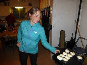
is an excellent treat. And treats! Elyssa stops by with cupcakes (yummy) as Barry J plays classical guitar
and the IG group finishes dinner and other tasks as hikers' midnight (9 p.m.) approaches. We wonder if
the BA group (Mike, Kathy, Holly, Annette) are similarly celebrating an excellent week.
Today, there's time for a second oiling of the amphitheater benches,
painting the ceiling of the info station, plugging rat holes with steel wool, Tom finishes making a bench
from an old bed, trimming trees, improving water egress from site #8 and near the info station, cleaning up, etc.
It's lightly raining on the TarpTent as hiker midnight plus 1 hour arrives.
Canyon Rover - Day 8
Day 9: Up and Out. Hike out of The Canyon via the Bright Angel Trail.
5 miles; ERM = 11.
It's a chilly morning in IG Camp, where the rain has splattered
mud up under the rain fly.
A final check occurs. Take off the tarps from the benches to reveal
the lovely oiled oak beneath. Check the numerous shade shelters to make sure we have gathered all
tools and such. Pile together the food storage buckets and store them in the Rock House for the next
service project. Inspect the bunkhouse for rough cleanliness and to make sure we collected all our stuff.
By this time I'm the sole remaining volunteer, and I wonder how Mike, Kathy, Annette, and Holly are
doing hiking up from BA.
The rise to the rim goes smoothly. Into a bit of wet snow and scads
of tourists. I'm compiling the excellent list of tasks accomplished as I gaze upon this wondrous chunk of
our precious public lands.
Canyon Rover - Day 9
"I measure your health by the number of shoes and hats and clothes
you have worn out." Ralph Waldo Emerson
"Under the desert sun, in the dogmatic clarity, the fables of theology
and the myths of classical philosophy dissolve like mist. The air is clean, the rock cuts
cruelly into flesh; shatter the rock and the odor of flint rises to your nostrils, bitter
and sharp. Whirlwinds dance across the salt flats, a pillar of dust by day; the thornbush
breaks into flame at night. What does it mean? It means nothing. It is as it is and has no
need for meaning. The desert lies beneath and soars beyond any possible human qualification.
Therefore, sublime."
Ed Abbey
*ERM: Energy Required Miles, are there data to support this
mileage adjustment?
Journal of Outdoor Recreation, Education and Leadership
Petzoldt first proposed his theory in his 1976 book “Teton Trails” to
help backpackers plan trips and calculate their energy needs on mountain trails. “Petzoldt defined one
energy mile as the energy required to walk one mile on the flat. He recommended adding two energy miles
for every 1,000 feet of elevation gain, so a person hiking one mile and 1,000 feet upward would use the
equivalent of three energy miles,” Phipps said.
Petzoldt’s energy mile theory was just a reflection of the mountaineer’s
“gut feeling,” Phipps said. The theory had never been tested in a laboratory before the study began in WCU’s
Exercise Physiology Laboratory in the spring of 2010, Phipps said.
To determine the validity of the theory, the study measured the energy cost
and perceived exertion for walking on flat ground, with and without a 44.5-pound backpack, and up an elevation
gain of 1,000 feet, with and without the backpack, through the collection of metabolic data, Phipps said.
Twenty-four student, faculty and staff volunteers, including 12 males and 12
females, went through four testing sessions as the research continued into fall semester of 2010. The study
results showed that the additional energy cost for ascending 1,000 feet ranged from 1.34 to 2.02 energy mile
equivalents, for an average of about 1.6 miles, compared to Petzoldt’s use of two energy miles for each 1,000
feet. The range revealed by the study was due to the “hikers” personal weight differences, Phipps said.
“It is remarkable that Petzoldt’s energy mile theory is so close to the actual energy cost measured during our
study,” Phipps said. “In the field of outdoor education, it’s important for leaders to include an estimation
of energy requirements during the planning of hiking trips.”
Phipps said the energy required for hiking up steep mountain trails would vary
for individuals and groups, and the variables of the trail would also factor in, but he recommends that
backpackers stick with Petzoldt’s idea of adding two energy miles for every 1,000 feet of elevation gain when
planning trips.
The Validity of Petzoldt's Energy Mile Theory, 2010
Authors: Maridy McNeff Troy, Maurice L. Phipps
Publication: Journal of Outdoor Recreation, Education, and Leadership
Links:

|
Tasks Accomplished List 3-2017 GCHBA (pdf)
(Click the image for the document)
|
|---|
Related Links:
Grand Canyon Hikers and Backpackers Association site (GCHBA)
GCHBA Service Projects Page
GCHBA Task List, Indian Garden and Phantom River Ranger Station (pdf; same list as seen above)
Finding Phantom: GCHBA Volunteer Service Project At Phantom RS (Ranger Station) and Bright Angel CG, 10-2016
VIP Cottonwood Rehabilitation Cruise:
GCHBA Volunteer Service Project At Cottonwood RS, 3-2016
Bonus Feature from the 3-2016 volunteer project: A Second Ribbon Oasis - AZ Daily Sun 3-30-2016, pdf
VIPs at IG - Volunteering at Indian Garden RS, 2015
GCHBA Gusher at BA - Volunteering at the bottom of The Canyon, 2015
Scenic Toilets of Inner Earth
the geology of the Grand Canyon by the NPS
Eaarth - Living on a fundamentally altered planet by Bill McKibben
Other WV reports about the Grand Canyon:
Click here or on the Looking Lizard to go to all WV reports about The Grand Canyon
|
|---|
Looking for All Wilderness Vagabond trip reports about the Grand Canyon?
Click the image to go to All WV reports about The Grand Canyon
|
|---|
|
More Truth Than Joke:
|
|---|
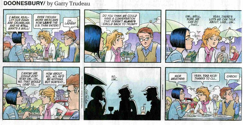
climate of doom
(Click the image for the full-size image)
|
|---|
|
|
|---|
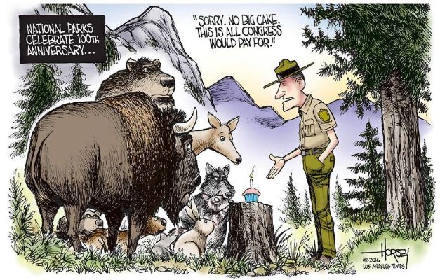
congress, fund the parks
(Click the image for the full-size image)
|
|---|
|


